English
Beta
Hygyrchedd
Hafan
Amdanom
Chwilio
Orielau
Map
Cymorth
Cysylltwch
Cofnod Archif
Canlyniadau
Safle Chwilio Uwch
Nid oes gennych resi chwilio datblygedig. Ychwanegwch un trwy glicio ar y botwm '+ Ychwanegu Rhes'
+ Ychwanegu Rhes
Chwilio
Ail Gychwyn
Bynea Village, Llanelli
AWP - Archaeology Wales Project Archives
AWP_320 - Archaeology Wales Project Archives
AWP_320_01 - Archaeology Wales Project Archives
AWP_320_01_10 - Archaeology Wales Project Archives
Further Information
Manylion
Hierarchaeth
Safleoedd Cysylltiedig
Rhif Archif
6533207
Disgrifiad
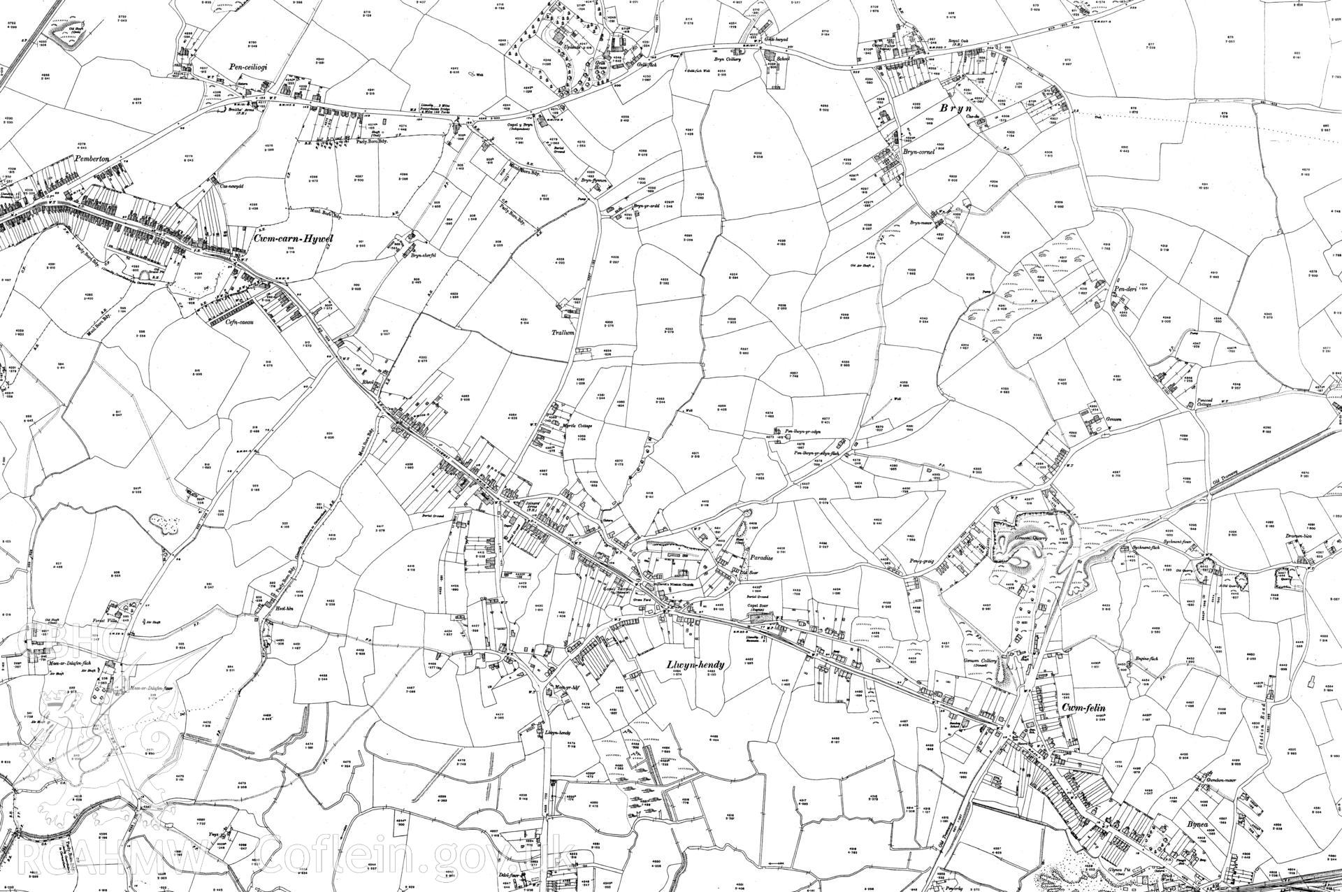
Third edition of 25 inch OS maps, published in 1916, reproduced by Landmark Information Group, showing the area around Bynea. Map included as part of archaeological appraisal of Gwndwn Mawr, Station Rd., Bynea, Carmarthenshire, 2014.
Cofnod Casglu
AWP - Archaeology Wales Project Archives
Cyfrwng
Cartographic.
Cychwynnwr
Archaeology Wales Ltd.
Dyddiad
c. 2014-02