Description
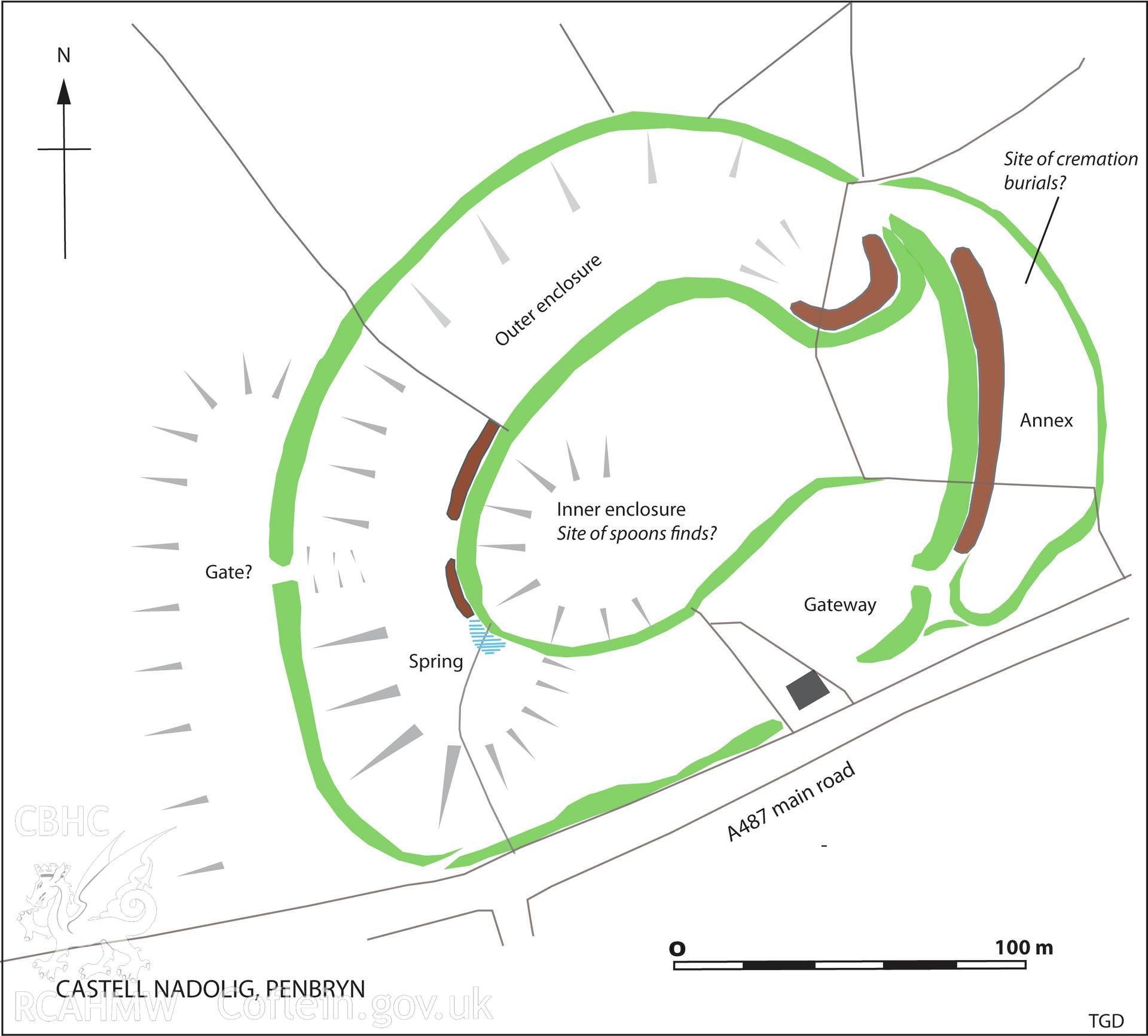
Castell Nadolig, Cwmtydu; .TIFF version of a plan of the hillfort showing detail of previously unmapped low earthworks and other topographic features. Note the position of the spring, and the way the earthworks and gateway are respected by the line of the present-day (and probably ancient) road Ramparts are shown in green, surviving ditches in brown. Figure 5.6, The Hillforts of Cardigan Bay, Toby Driver.