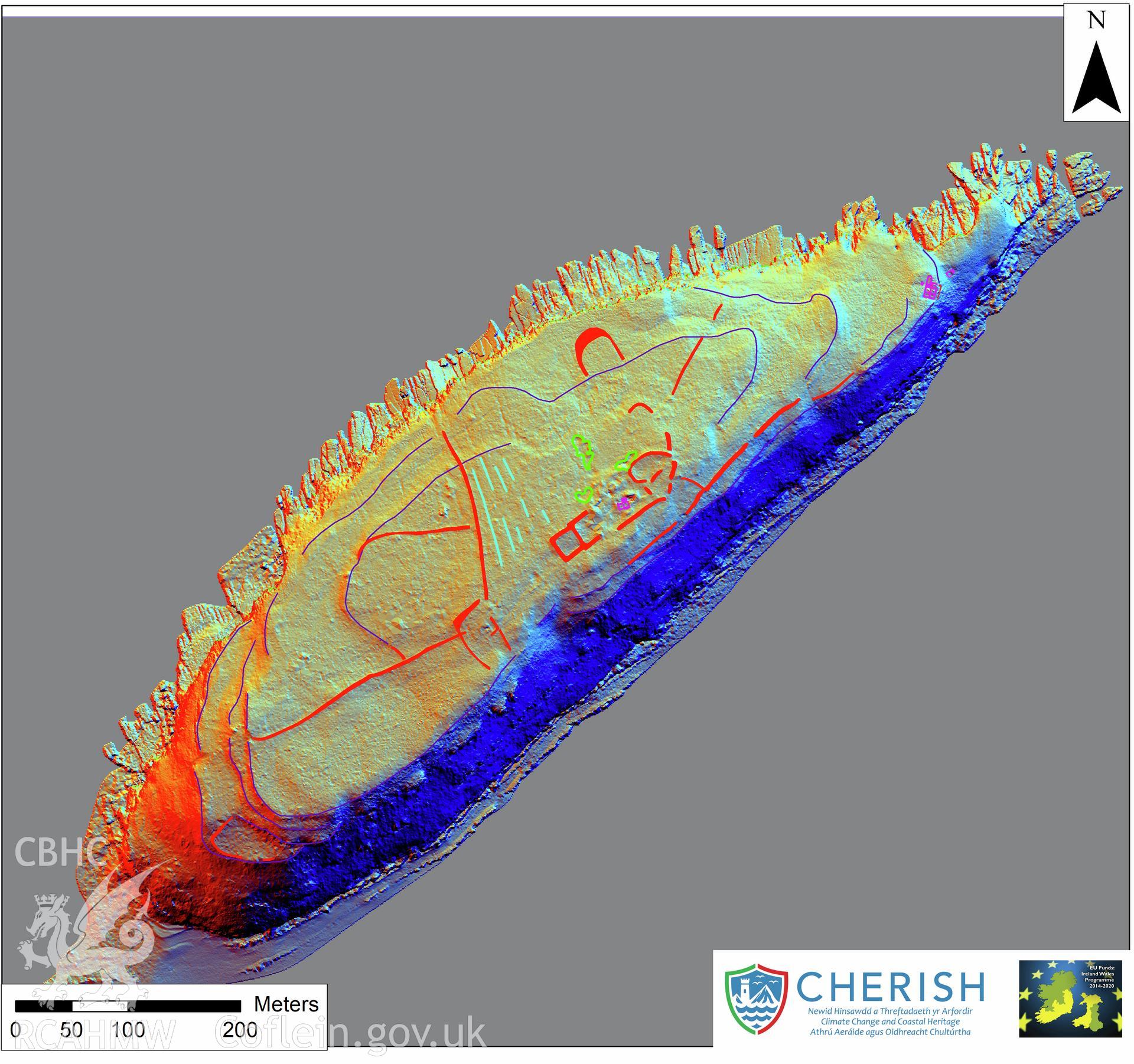
You have no advanced search rows. Add one by clicking the '+ Add Row' button
Ynys Seiriol (Puffin Island). Archaeological mapping over airborne laser scanning (LiDAR) commissioned by the CHERISH Project 2017-2021, flown by Bluesky International LTD at low tide on 24th February 2017. Digital Terrain Model (DTM) showing whole of the island with multi hill shading and aerialFurther Information
Archive Number
6540748
Description
Ynys Seiriol (Puffin Island). Archaeological mapping over airborne laser scanning (LiDAR) commissioned by the CHERISH Project 2017-2021, flown by Bluesky International LTD at low tide on 24th February 2017. Digital Terrain Model (DTM) showing whole of the island with multi hill shading and aerial
Collection Record
CHR - CHERISH Project Archive
Medium
Photo.
Originator
RCAHMW, Bluesky International Ltd
Date
2017