CHERISH Project Archive
Archive Details
Catalogue Number C671513
Accession Number NA/GEN/2019/045
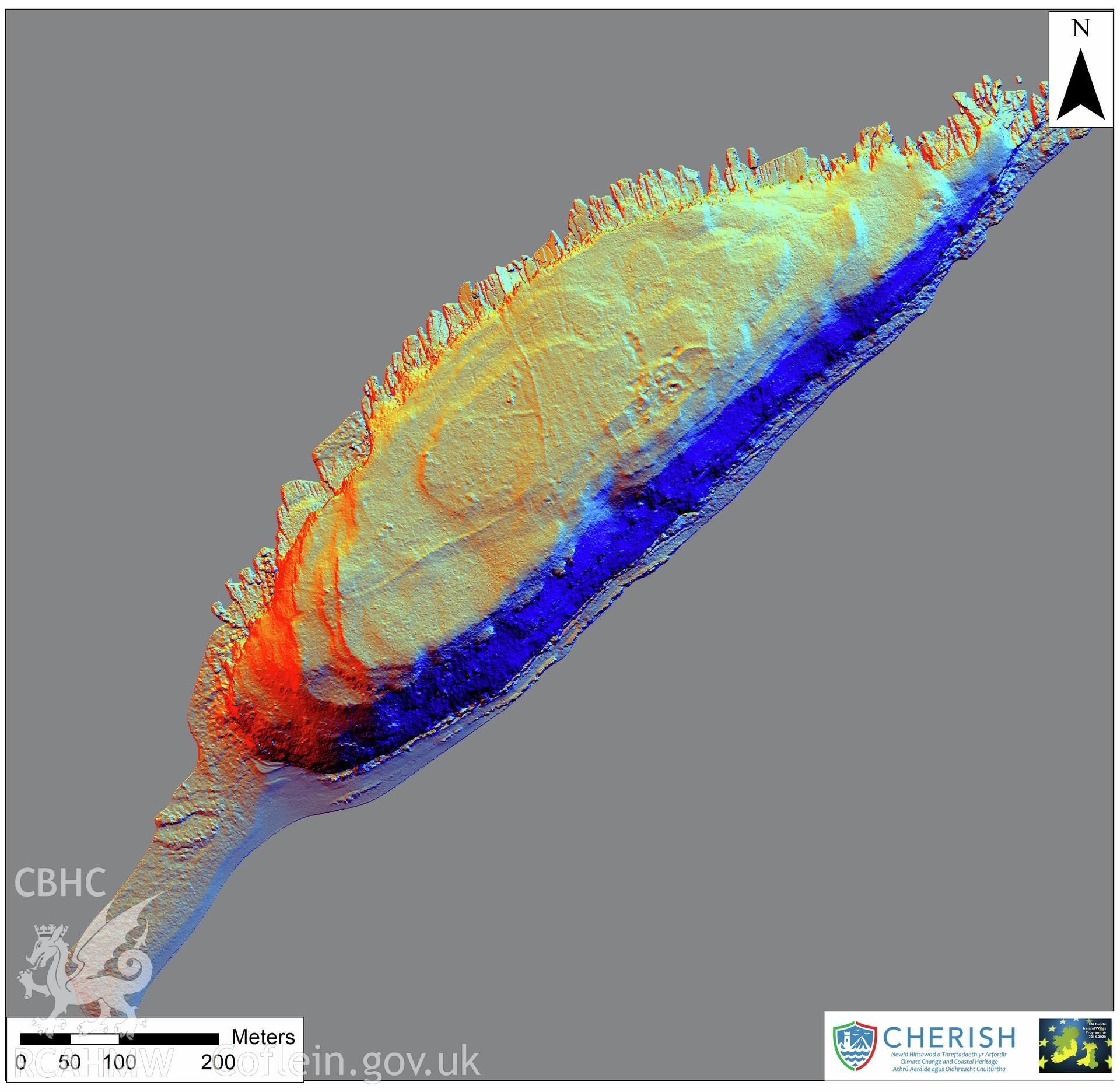
Scope and Content Ynys Seiriol (Puffin Island). Airborne laser scanning (LiDAR) commissioned by the CHERISH Project 2017-2021, flown by Bluesky International LTD at low tide on 24th February 2017. Digital Terrain Model (DTM) showing whole of the island with multi hill shading.
Collection CHERISH Project Archive
Medium photo
Date 2017
Reference CHR_04_04_02_14
C628050 CHERISH Project Archive - Collection Level
C671461 Data from an airborne laser scanning survey (LiDAR) commissioned by the EU-funded CHERISH Project from providers Bluesky International Ltd in 2017. - Group Level
C671480 Set of final LiDAR images produced from an airborne laser scanning survey commissioned by the EU-funded CHERISH Project from providers Bluesky International Ltd in 2017. - Sub-Group Level
C671499 Set of final LiDAR images of Puffin Island produced from an airborne laser scanning survey commissioned by the EU-funded CHERISH Project from providers Bluesky International Ltd in 2017. - Batch Level
C671513 Ynys Seiriol (Puffin Island). Airborne laser scanning (LiDAR) commissioned by the CHERISH Project 2017-2021, flown by Bluesky International LTD at low tide on 24th February 2017. Digital Terrain Model (DTM) showing whole of the island with multi hill - Item Level
NPRN | Site Name | Type of Site | Community | Collections | Images |
---|---|---|---|---|---|
527 | CELL OF PENMON PRIORY ON PRIESTHOLM ISLAND, PUFFIN ISLAND OR YNYS SEIRIOL, THE MONASTIC SETTLEMENT | CHURCH, MONASTERY, PRIORY | Llangoed | 112 | 61 |
424034 | PUFFIN ISLAND OR YNYS SEIRIOL ISLAND LANDSCAPE | ISLAND, LANDSCAPE | Llangoed | 50 | 42 |