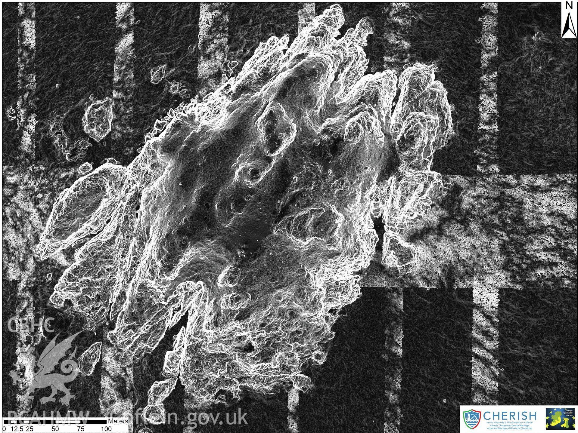
You have no advanced search rows. Add one by clicking the '+ Add Row' button
Ynys Gwales (Grassholm Island). Airborne laser scanning (LiDAR) commissioned by the CHERISH Project 2017-2021, flown by Bluesky International LTD at low tide on 24th February 2017. Digital Terrain Model (DTM) showing the overall view of the island with slope highlights.Further Information
Archive Number
6540773
Description
Ynys Gwales (Grassholm Island). Airborne laser scanning (LiDAR) commissioned by the CHERISH Project 2017-2021, flown by Bluesky International LTD at low tide on 24th February 2017. Digital Terrain Model (DTM) showing the overall view of the island with slope highlights.
Collection Record
CHR - CHERISH Project Archive
Medium
Graphic.
Originator
RCAHMW, Bluesky International Ltd
Date
2017