Description
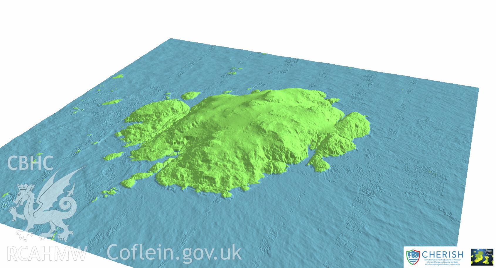
Ynys Gwales (Grassholm Island). Airborne laser scanning (LiDAR) commissioned by the CHERISH Project 2017-2021, flown by Bluesky International LTD at low tide on 24th February 2017. View showing Grassholm Island facing north-west.
Collection Record
CHR - CHERISH Project Archive
Originator
RCAHMW, Bluesky International Ltd