Archive Number
6532960
Description
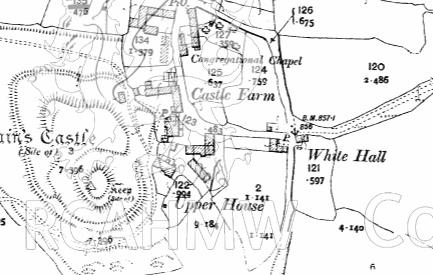
Digital copy of a map from 1903 showing the village of Painscastle, with Pain's castle and Upper House clearly labelled. Included as material relating to archaeological field evaluation of Upper House Farm, written by Chris E Smith of Archaeology Wales.
Collection Name
AWP - Archaeology Wales Project Archives
Medium
Cartographic.
Originator
Archaeology Wales Ltd.
Date
c. 2014
Digital copy of a map from 1903 showing the village of Painscastle, with Pain's castle and Upper House clearly labelled. Included as material relating to archaeological field evaluation of Upper House Farm, written by Chris E Smith of Archaeology Wales.Download and purchase options