• Cymraeg
  •    Accessibility
    coflein logo
    • Home
    • About
    • Search
    • Galleries
    • Map
    • Help
    • Contact / Order

    • Search Results
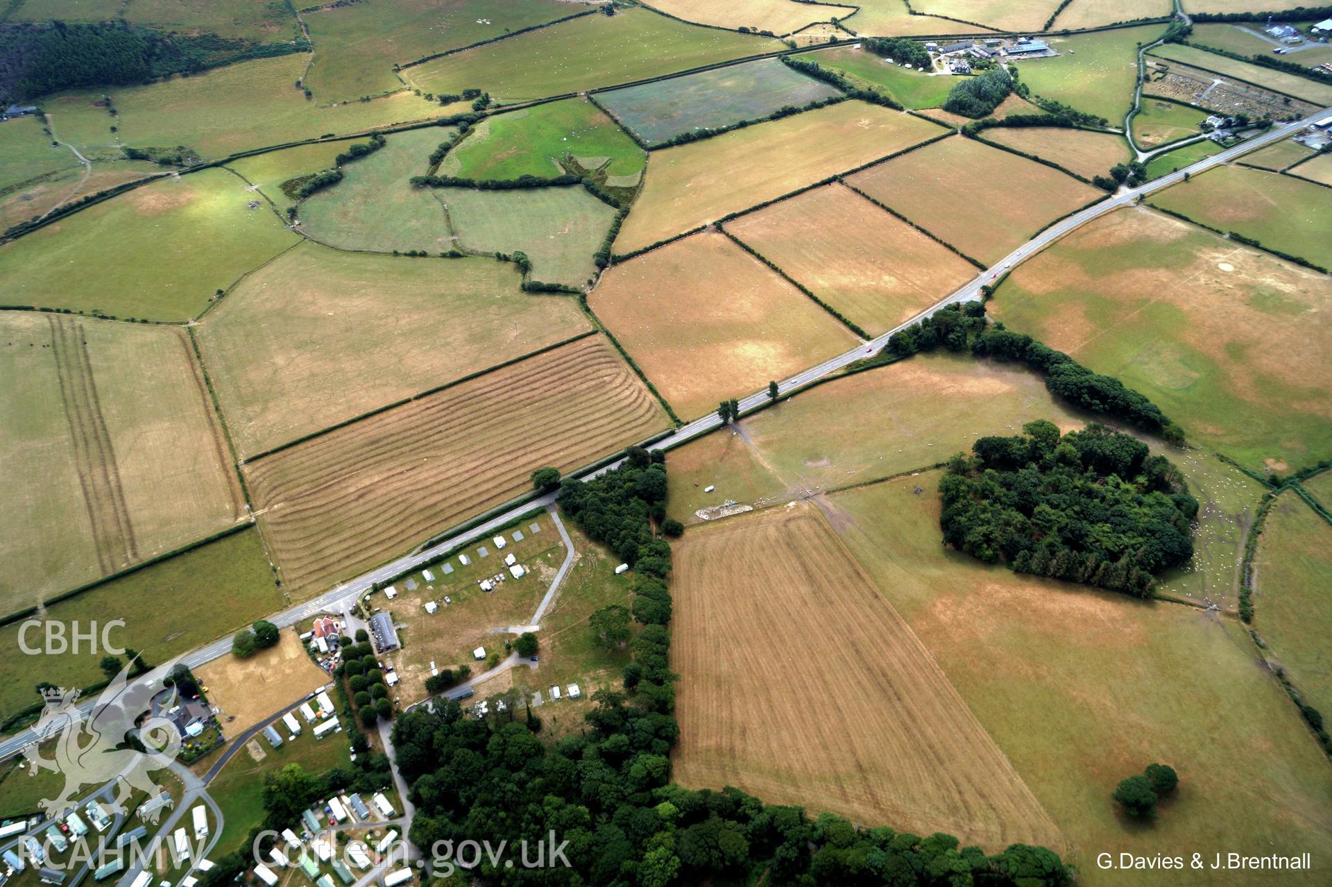
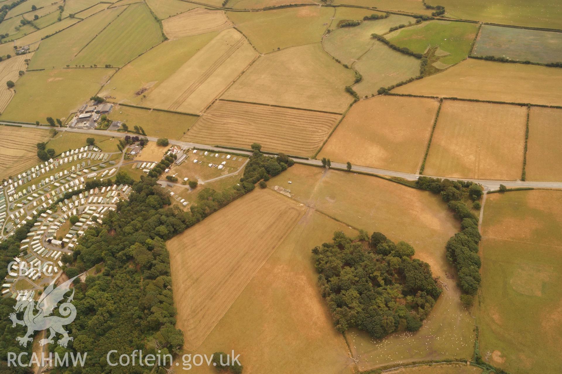
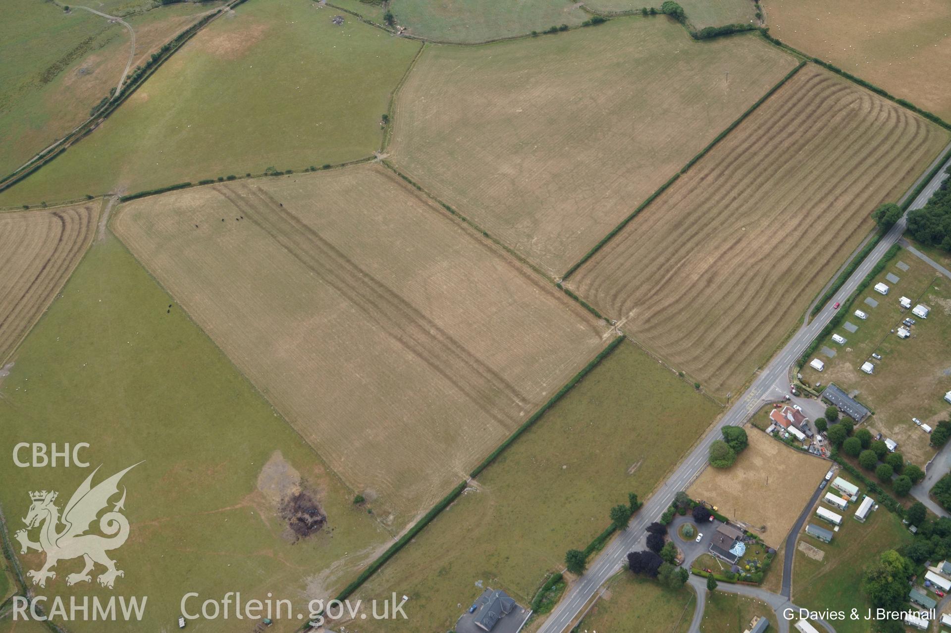
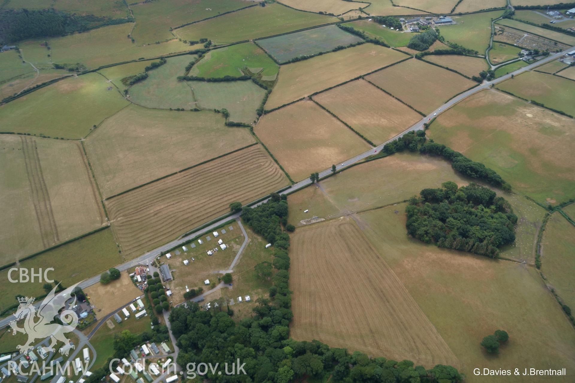
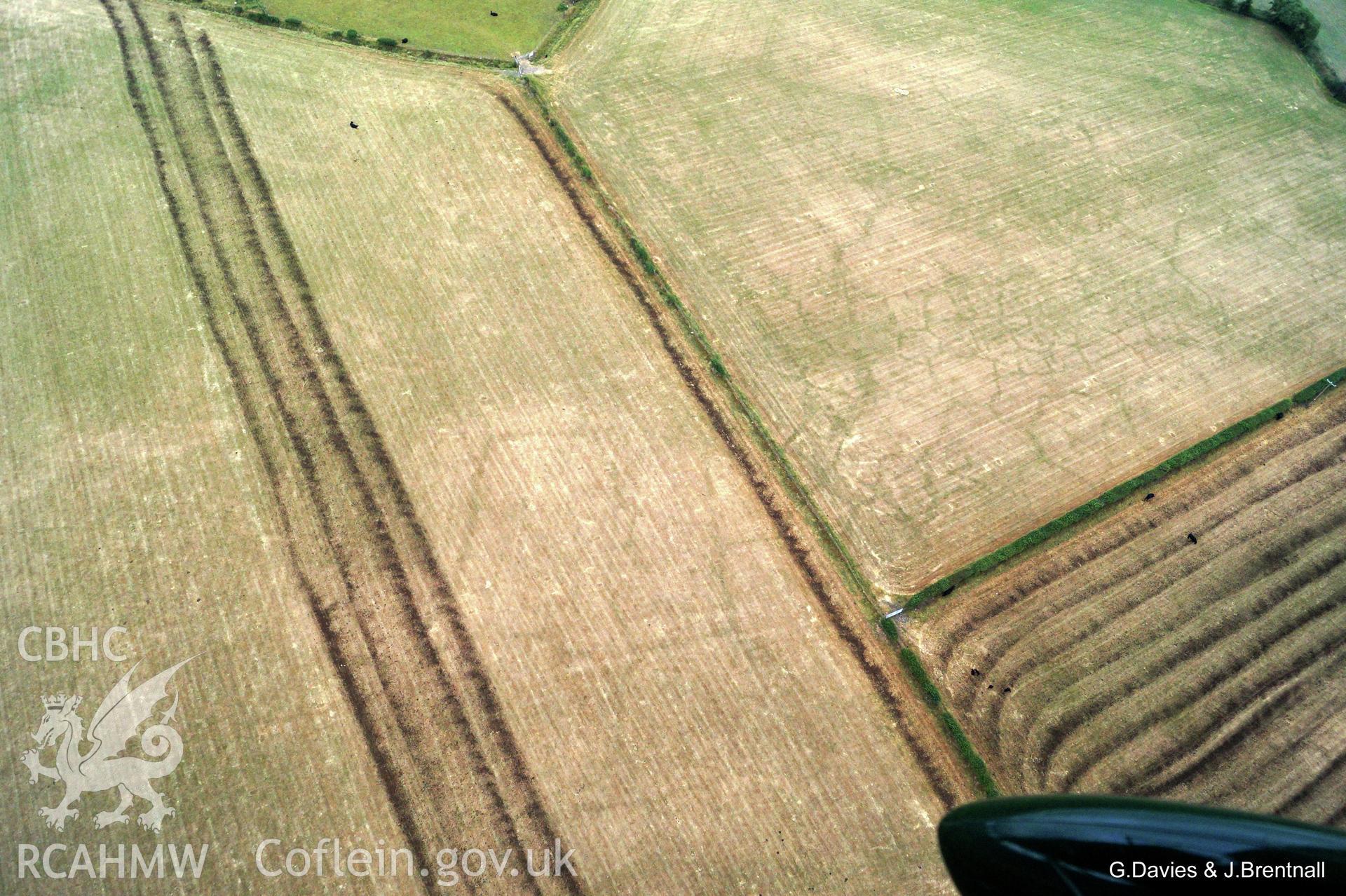
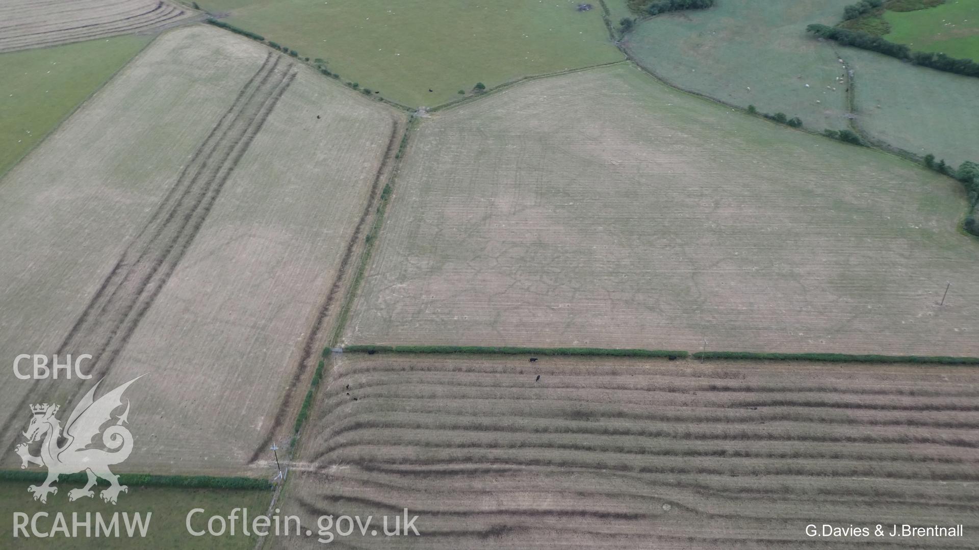
    • Cropmarks in A Field South East of Ynysmaengwyn Caravan Park, Tywyn
    Details
    Images
    Related Sites
    Related Archives
    Loading Filter Panel
    per page
    • 1
    • 2
    Wide shot aerial photograph of Square Barrow Cemetery & cropmarks near Ynysmaengwyn, taken by Glyn Davies & Jonathan Brentnall 16/07/2018 under drought conditions. Photograph modified to enhance visibility of archaeology. Original photograph: BDC_04_03_04.Aerial photograph of cropmarks south east of Ynysmaengwyn caravan park, taken by Glyn Davies & Jonathan Brentnall 16/07/2018 under drought conditions. Photograph is original. For modified version enhancing visibility of archaeology, see: BDC_04_02_01 & 2.Wide shot aerial photograph of Square Barrow Cemetery & cropmarks near Ynysmaengwyn, taken by Glyn Davies & Jonathan Brentnall 16/07/2018 under drought conditions. Original Photograph. For modified version with archaeology highlighted see BDC_04_03_01.Aerial photograph of cropmarks south east of Ynysmaengwyn caravan park, taken by Glyn Davies & Jonathan Brentnall 16/07/2018 under drought conditions. Photograph is original. For modified version enhancing visibility of the archaeology, see: BDC_04_02_04.Wide shot aerial photograph of Square Barrow Cemetery & cropmarks near Ynysmaengwyn, taken by Glyn Davies & Jonathan Brentnall 16/07/2018 under drought conditions. Photograph modified & archaeological features highlighted. Original photograph:BDC_04_03_02.Aerial photograph of cropmarks south east of Ynysmaengwyn caravan park, taken by Glyn Davies & Jonathan Brentnall 16/07/2018 under drought conditions. Photograph has been modified to enhance visibility of the archaeology. Original photograph: BDC_04_02_03Wide shot aerial photograph of Square Barrow Cemetery & cropmarks near Ynysmaengwyn, taken by Glyn Davies & Jonathan Brentnall 16/07/2018 under drought conditions. Original Photograph. For modified version with clearer view of archaeology see BDC_04_03_03.Aerial photograph of cropmarks south east of Ynysmaengwyn caravan park, taken by Glyn Davies & Jonathan Brentnall 16/07/2018 under drought conditions. Photograph has been modified to enhance visibility of the archaeology. Original photograph: BDC_04_02_03Aerial photograph of cropmarks south east of Ynysmaengwyn caravan park, taken by Glyn Davies & Jonathan Brentnall 16/07/2018 under drought conditions. Photograph is original. For modified version enhancing visibility of the archaeology, see: BDC_04_02_06.Aerial photograph of cropmarks south east of Ynysmaengwyn caravan park, taken by Glyn Davies & Jonathan Brentnall 16/07/2018 under drought conditions. Photograph has been modified to enhance visibility of the archaeology. Original photograph: BDC_04_02_07.

    We are using cookies to give you the best experience on our website.

    You can find out more about which cookies we are using or switch them off in .

    Coflein
    Powered by  GDPR Cookie Compliance
    Privacy Overview

    This website uses cookies so that we can provide you with the best user experience possible. Cookie information is stored in your browser and performs functions such as recognising you when you return to our website and helping our team to understand which sections of the website you find most interesting and useful.

    Strictly Necessary Cookies

    Strictly Necessary Cookie should be enabled at all times so that we can save your preferences for cookie settings.

    Analytics

    This website uses Google Analytics to collect anonymous information such as the number of visitors to the site, and the most popular pages.

    Keeping this cookie enabled helps us to improve our website.

    RCAHMW logo
    Comisiwn Brenhinol
    Henebion Cymru


    Royal Commission on the Ancient and
    Historical Monuments of Wales
    • Accessibility
    • Privacy and Cookies
    • Glossary
    • Contact / Order
    • Legals
    • Help
    • Sitemap
    • Royal Commission website
    Connect with us
    dragon logo Facebook logo Twitter logo
    © 2021 Non-commercial Government Licence