• Cymraeg
  •    Accessibility
    coflein logo
    • Home
    • About
    • Search
    • Galleries
    • Map
    • Help
    • Contact / Order

    • Search Results
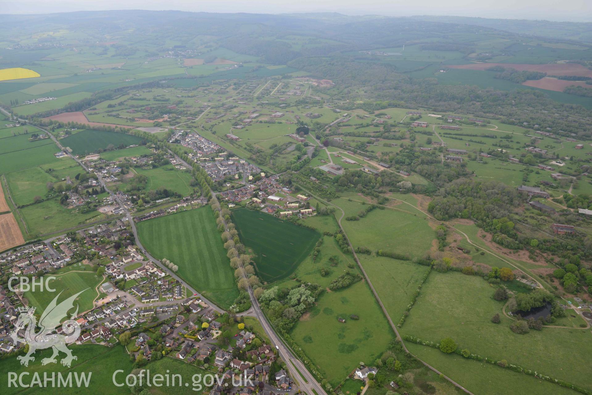
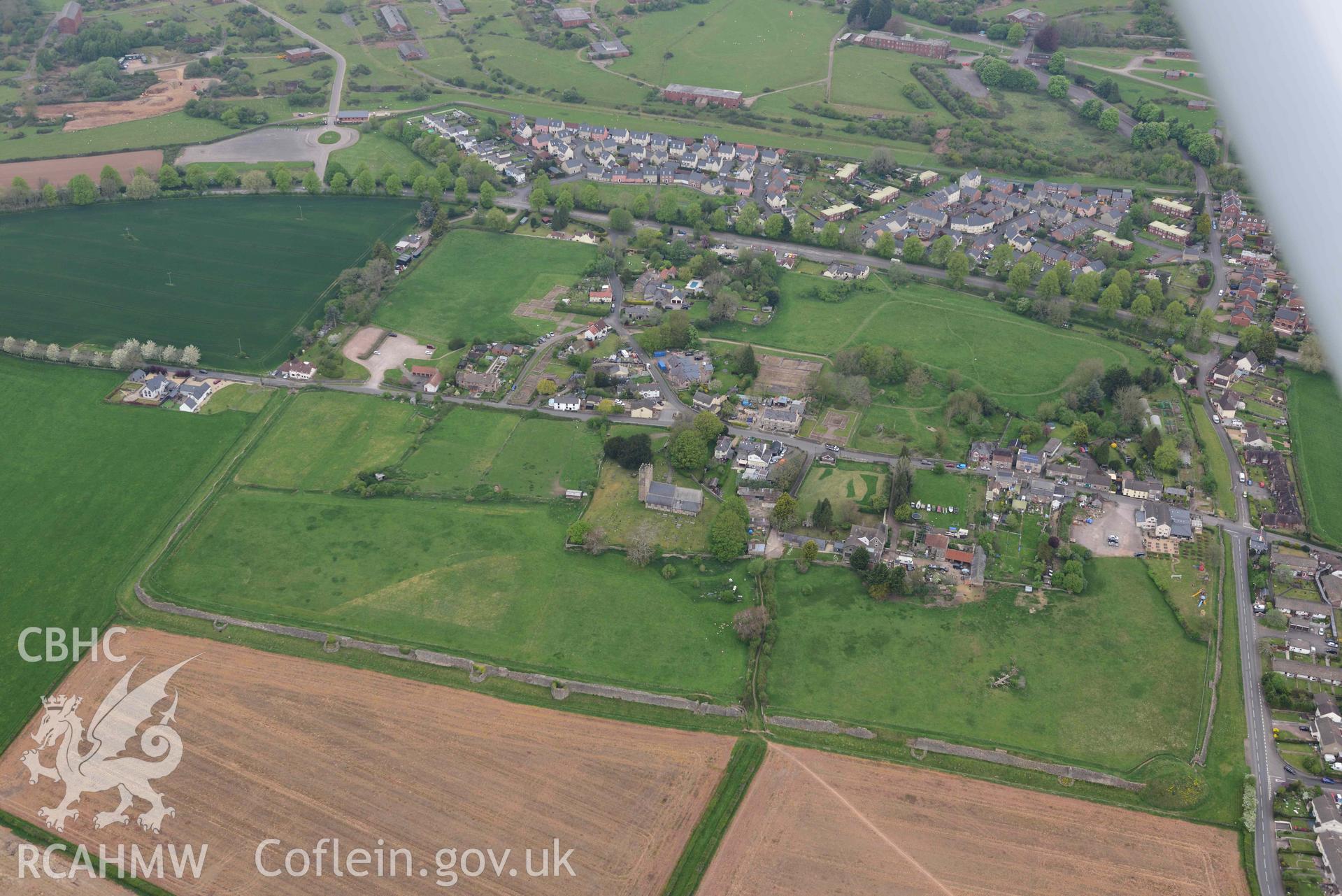
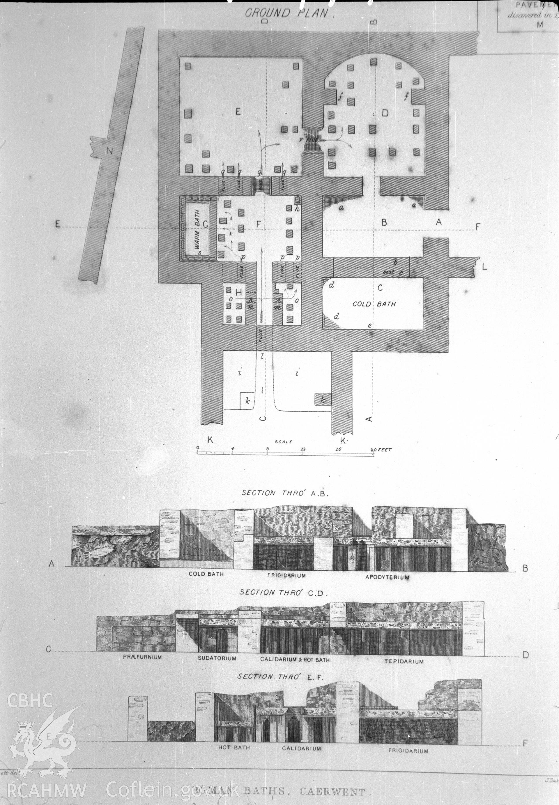
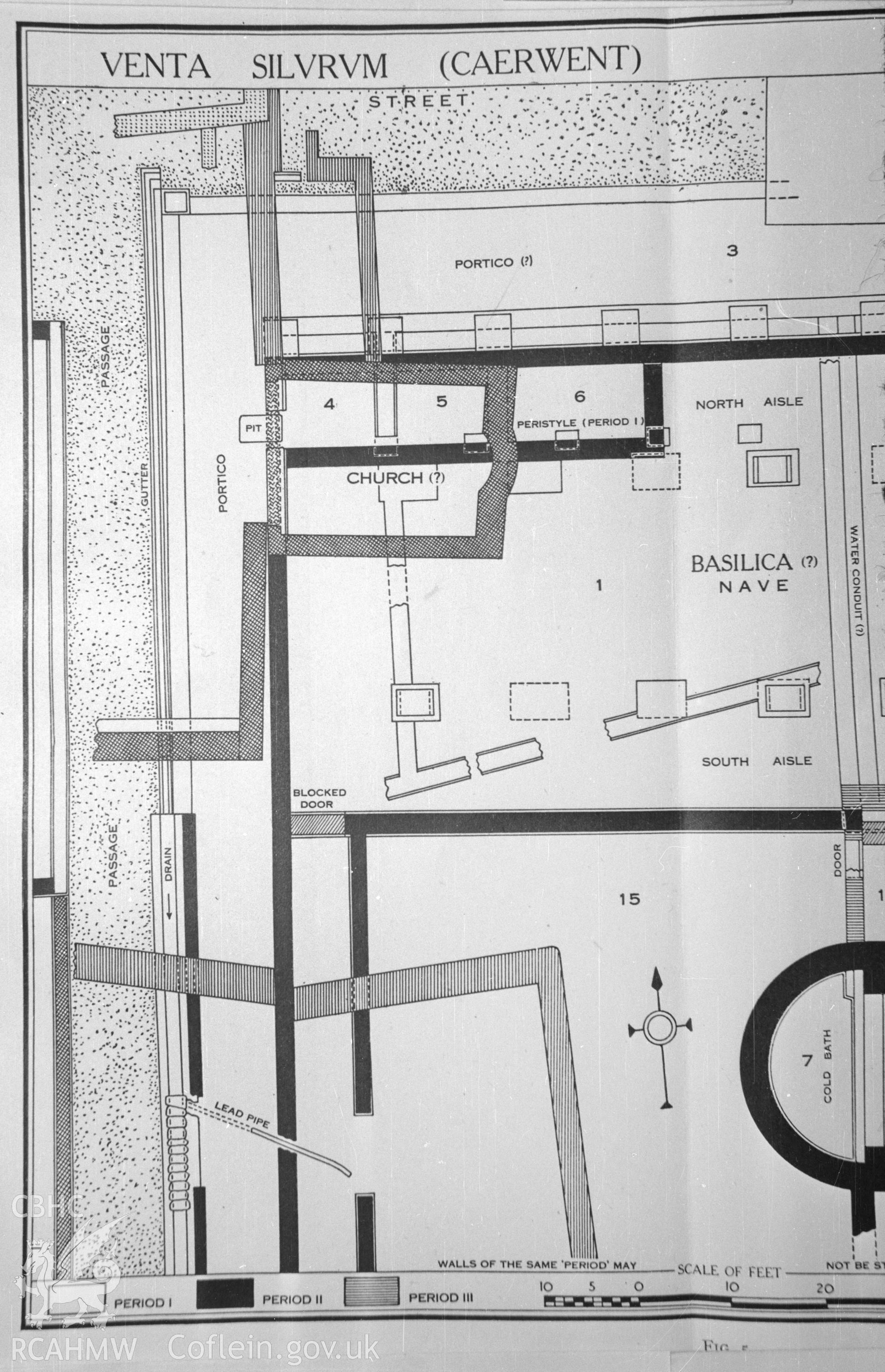
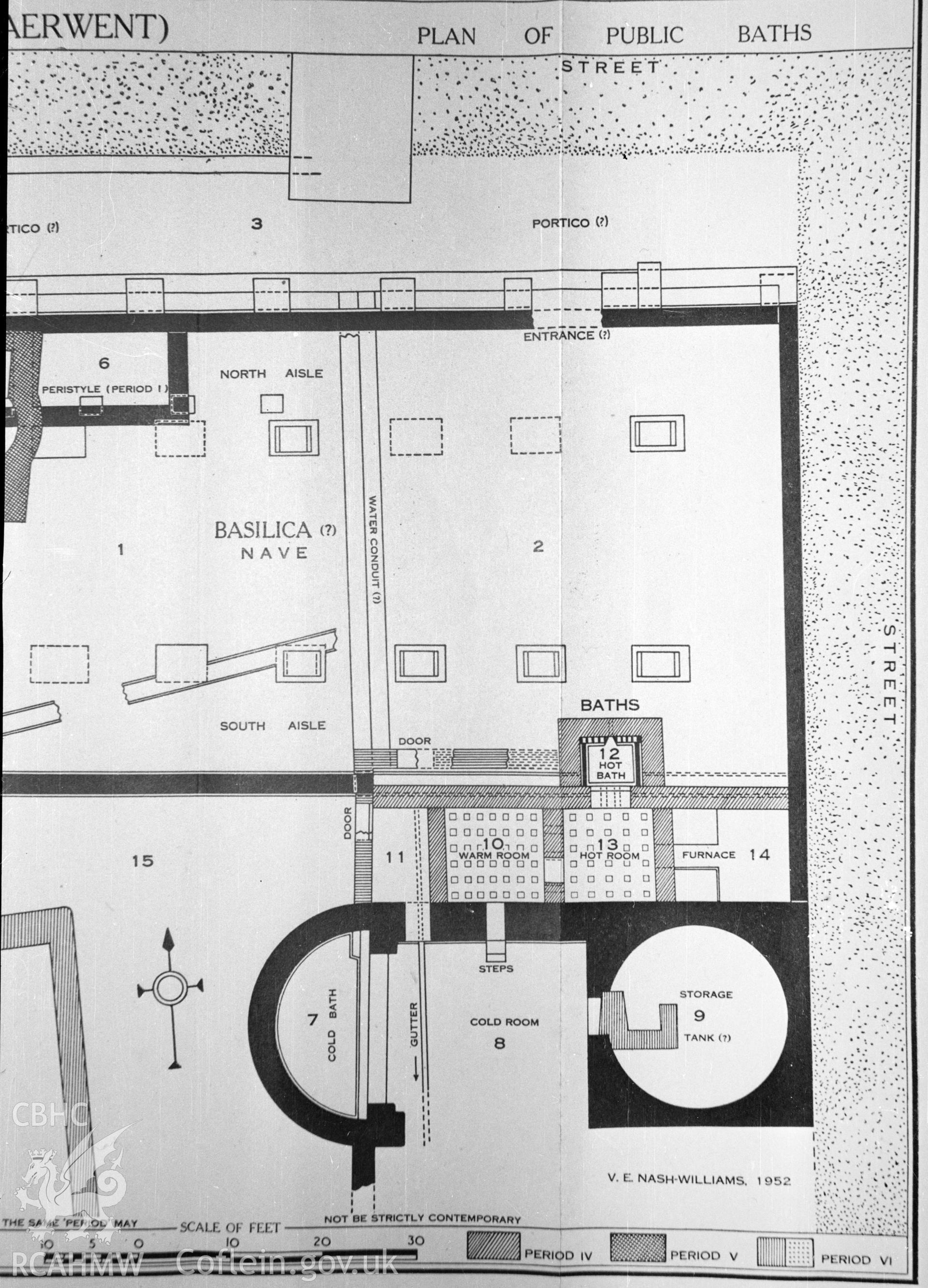
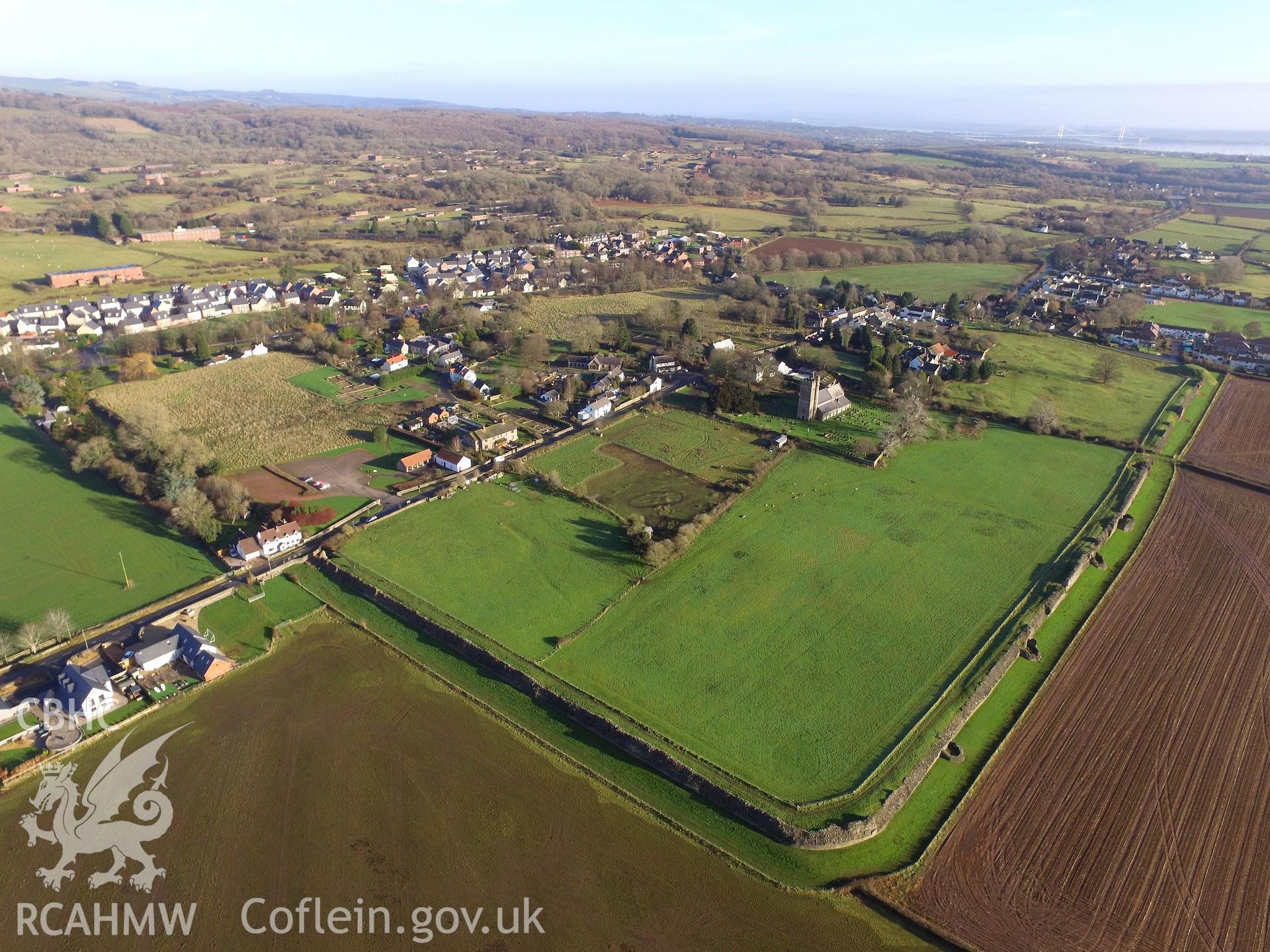
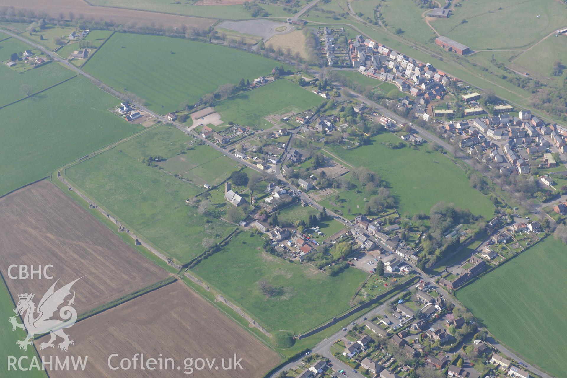
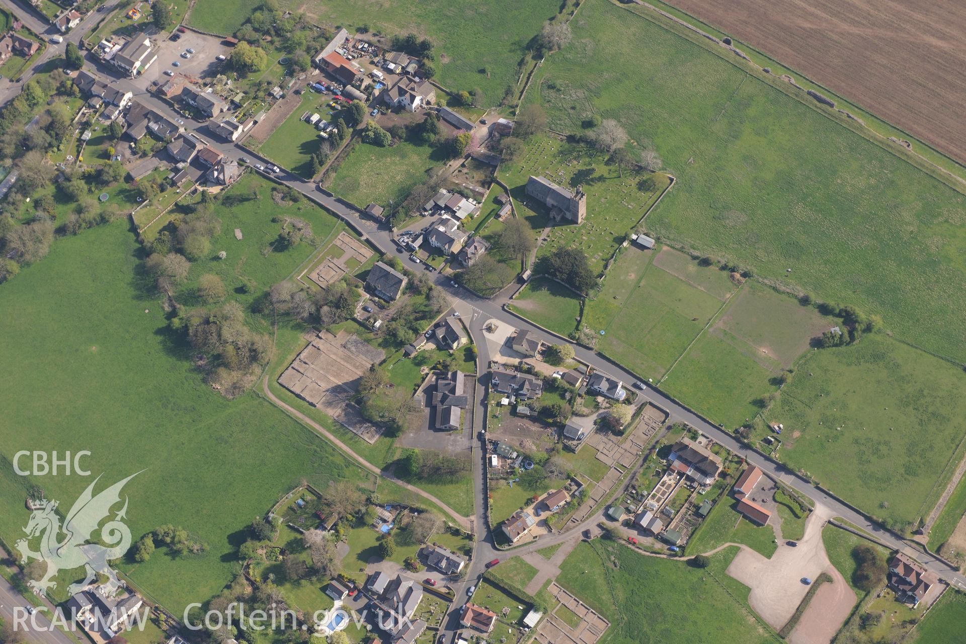
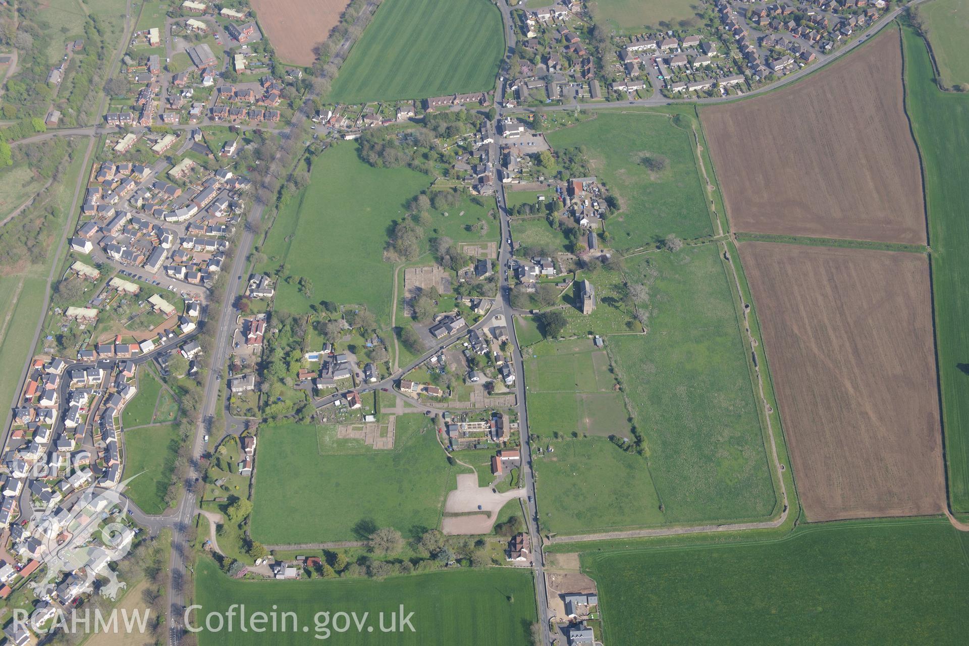
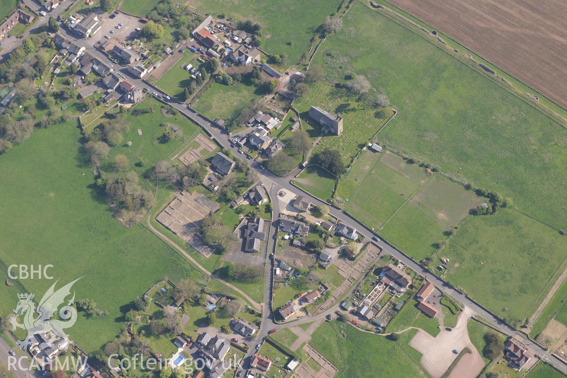
    • Caerwent Roman City; Venta Silurum
    Details
    Images
    Related Sites
    Related Archives
    Loading Filter Panel
    per page
    • 1
    • 2
    • 3
    • ...
    • 13
    Caerwent Roman City, from the south. Oblique aerial photograph taken during the Royal Commission's programme of archaeological aerial reconnaissance by Toby Driver on 29 April 2022.Caerwent Roman City, from the east. Oblique aerial photograph taken during the Royal Commission's programme of archaeological aerial reconnaissance by Toby Driver on 29 April 2022.Digital copy of a nitrate negative of a sketch depicting a ground plan of the roman baths at Caerwent, by Ordnance Survey.Digital copy of a nitrate negative of a sketch depicting the outline of Venta Silurum (Caerwent), taken by Ordnance Survey.Digital copy of a nitrate negative of a sketch depicting 'plan of public baths' at the roman site in Caerwent, by Ordnance Survey.Photo showing Caerwent, taken by Paul R. Davis, December 2017.Caerwent village and Roman city including views of the Roman Amphitheatre and Basilica and Forum; St. Stephen's Church; Caerwent House; Great House and West Gate Farm. Oblique aerial photograph taken during the Royal Commission's programme of archaeological aerial reconnaissance by Toby Driver on 21st April 2015.Caerwent village and Roman city including views of the Roman Amphitheatre and Basilica and Forum; Motte; St. Stephen's Church; Caerwent Baptist Chapel; Caerwent Institute Caerwent House; Great House and West Gate Farm. Oblique aerial photograph taken during the Royal Commission's programme of archaeological aerial reconnaissance by Toby Driver on 21st April 2015.Caerwent village and Roman city including views of the Roman Amphitheatre and Basilica and Forum; St. Stephen's Church; Caerwent House; Great House and West Gate Farm. Oblique aerial photograph taken during the Royal Commission's programme of archaeological aerial reconnaissance by Toby Driver on 21st April 2015.Caerwent village and Roman city including the Roman Amphitheatre and Basilica; St. Stephen's Church; the Motte, Caerwent House; Great House and West Gate Farm. Oblique aerial photograph taken during the Royal Commission's programme of archaeological aerial reconnaissance by Toby Driver on 21st April 2015.

    We are using cookies to give you the best experience on our website.

    You can find out more about which cookies we are using or switch them off in .

    Coflein
    Powered by  GDPR Cookie Compliance
    Privacy Overview

    This website uses cookies so that we can provide you with the best user experience possible. Cookie information is stored in your browser and performs functions such as recognising you when you return to our website and helping our team to understand which sections of the website you find most interesting and useful.

    Strictly Necessary Cookies

    Strictly Necessary Cookie should be enabled at all times so that we can save your preferences for cookie settings.

    If you disable this cookie, we will not be able to save your preferences. This means that every time you visit this website you will need to enable or disable cookies again.

    3rd Party Cookies

    This website uses Google Analytics to collect anonymous information such as the number of visitors to the site, and the most popular pages.

    Keeping this cookie enabled helps us to improve our website.

    Please enable Strictly Necessary Cookies first so that we can save your preferences!

    RCAHMW logo
    Comisiwn Brenhinol
    Henebion Cymru


    Royal Commission on the Ancient and
    Historical Monuments of Wales
    • Accessibility
    • Privacy and Cookies
    • Glossary
    • Contact / Order
    • Legals
    • Help
    • Sitemap
    • Royal Commission website
    Connect with us
    dragon logo Facebook logo Twitter logo
    © 2021 Non-commercial Government Licence