Cymraeg
Beta
Accessibility
Home
About
Search
Galleries
Map
Help
Contact
Archive Record
Results
Site Advanced Search
You have no advanced search rows. Add one by clicking the '+ Add Row' button
+ Add Row
Search
Reset
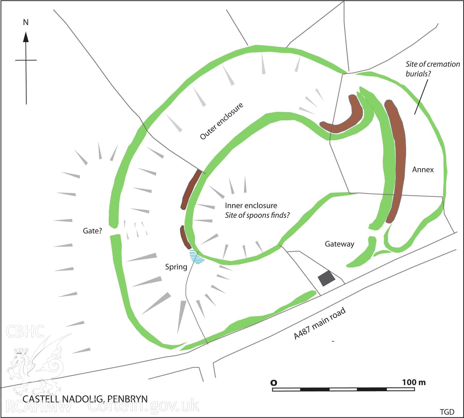
Castell Nadolig Hillfort, Findspot of The Late Iron Age Penbryn Spoons
General Digital Donations Collection
DD2018_003 - General Digital Donations Collection
DD2018_003_03 - General Digital Donations Collection
Further Information
Details
Hierarchy
Related Sites
NPRN
Title
Type Of Site
Collections
Images
NPRN
304136
Title
Castell Nadolig Hillfort, Findspot of The Late Iron Age Penbryn Spoons
Type Of Site
HILLFORT
Collections
49
Images
28