English
Hygyrchedd
Hafan
Amdanom
Chwilio
Orielau
Map
Cymorth
Cysylltwch / Trefn
Cofnod Archif
Canlyniadau Chwilio
Porth y Pistyll Quay
General Digital Donations Collection
DD2022_001 - General Digital Donations Collection
DD2022_001_001 - General Digital Donations Collection
DD2022_001_001_001 - General Digital Donations Collection
Manylion
Hierarchaeth
Safleoedd Cysylltiedig
Rhif Archif
2022-06-28_3469
Disgrifiad
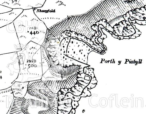
Section of 1918 Ordnance Survey map, 'cropped to harbour area,' showing Porth y Pistyll, Aberdaron. Produced in 2020 by Michael Statham.
Enw Casgliad
General Digital Donations Collection
Cyfrwng
1 .jpg file (137 KB). Cartographic.
Cychwynnwr
Michael Statham
Dyddiad
2020
Opsiynau lawrlwytho a prynu
 Opsiynau lawrlwytho a prynu