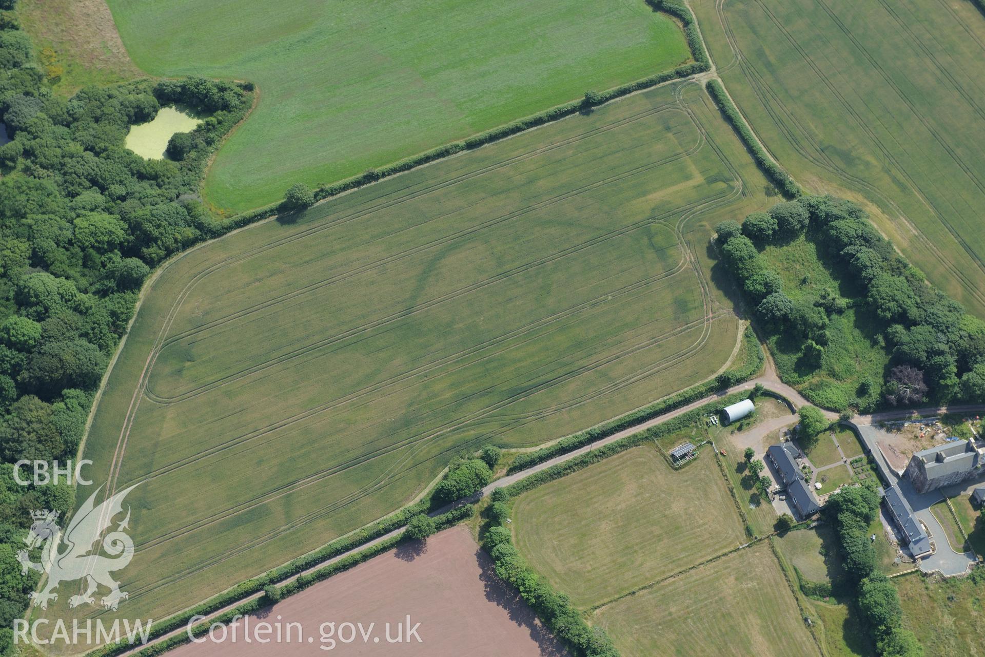
Butterhill farm with cropmarks east south south of the main farm buildings, near St Ishmaels. Oblique aerial photograph taken during the Royal Commission?s programme of archaeological aerial reconnaissance by Toby Driver on 16th July 2013.
Enw Casgliad
AP - RCAHMW Colour Oblique Digital Aerial Photographs
 Opsiynau lawrlwytho a prynu