English
Beta
Hygyrchedd
Hafan
Amdanom
Chwilio
Orielau
Map
Cymorth
Cysylltwch
Cofnod Archif
Canlyniadau
Safle Chwilio Uwch
Nid oes gennych resi chwilio datblygedig. Ychwanegwch un trwy glicio ar y botwm '+ Ychwanegu Rhes'
+ Ychwanegu Rhes
Chwilio
Ail Gychwyn
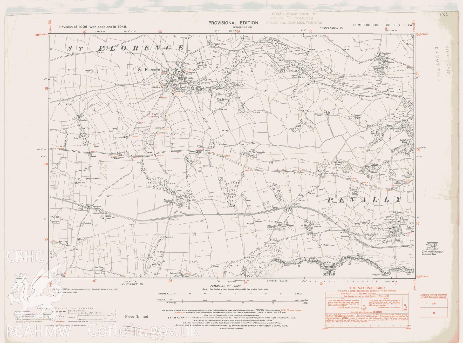
St Florence Village
Ordnance Survey Provisional Edition 6' County Series Maps
PE.XLI.SW - Ordnance Survey 2nd Edition 6' County Series Maps
Further Information
Manylion
Hierarchaeth
Safleoedd Cysylltiedig
Rhif Archif
6168405
Disgrifiad
Digital copy of a provisional edition Ordnance Survey map. A revision of the 1906 map, with additions in 1948, covering the St. Florence area.
Cofnod Casglu
Ordnance Survey Provisional Edition 6' County Series Maps
Cyfrwng
Cartographic.
Cychwynnwr
Ordnance Survey
Dyddiad
c. 1946